
Why Planes Don't Fly in Straight Lines on Maps
On a flat map a plane's route looks curved and bent. Here is why the shortest line between two cities is not a straight line at all.
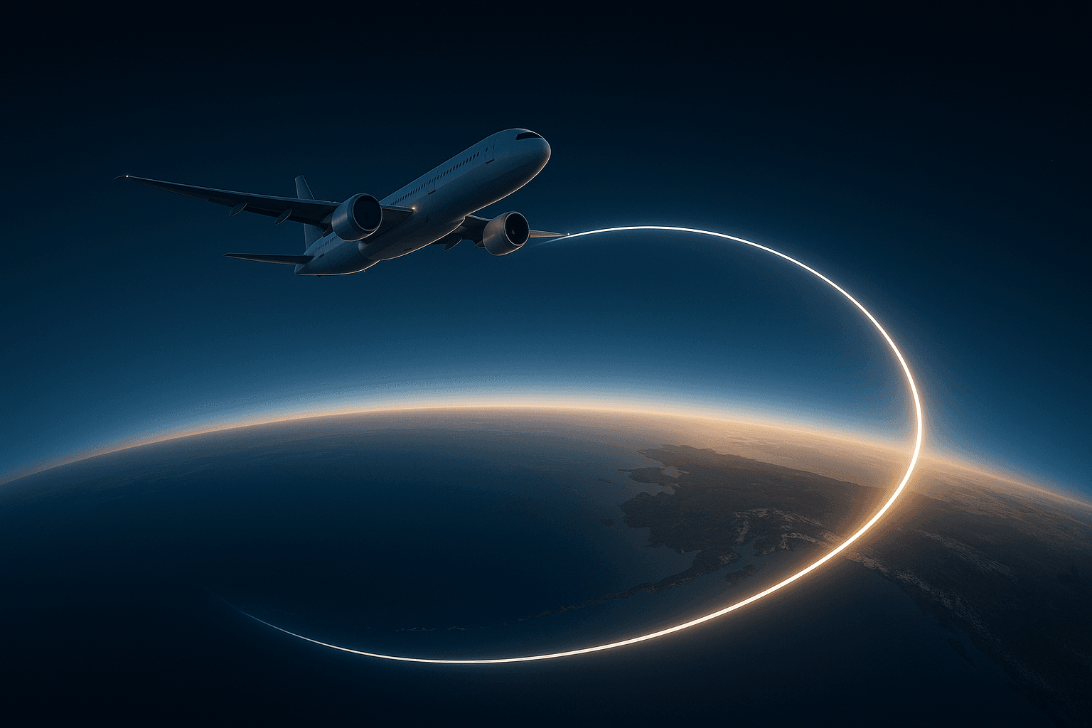
You open the flight map on the seat-back screen and something looks off. The plane from New York to Tokyo does not cross the Pacific in a straight line heading west: it climbs north, brushes past Alaska and the Aleutian Islands, and only then drops down toward Japan. It looks like an absurd detour, as if the pilot had taken a wrong turn. And yet it is, exactly, the shortest route possible. The explanation lies not in the plane or the pilot but in something far older: the Earth is a sphere and maps are flat.
The trap of flattening a ball
The problem begins long before the airplane. When you try to represent a curved surface —that of a globe— on a flat sheet, it is impossible to do so without distorting something: either distances, or areas, or shapes. There is no way to flatten an orange peel without tearing or stretching it. Every world map is, by necessity, a compromise: it decides which error to accept in exchange for which advantage.
The map most of us carry in our heads is the Mercator projection, created by the Flemish cartographer Gerardus Mercator in 1569. Its genius was designed for sailors: on a Mercator map, a line of constant bearing —always sailing, say, "northeast"— appears as a straight line. That turned navigation into something as simple as drawing a line with a ruler and following the compass. In exchange, Mercator pays a brutal price near the poles: it stretches high latitudes to the point of absurdity. That is why Greenland looks the size of Africa when in fact it fits inside it about fourteen times.
The great circle: the straight line hidden in the sphere
On a sphere, the shortest distance between two points is not a straight line (on a ball there are no straight lines) but an arc of a great circle: the circle you get by cutting the sphere with a plane that passes through its center, like the equator or any of the meridians. That arc is the spherical equivalent of the straight line, and mathematicians call it a geodesic.
Here is the trick that fools the eye. When you take that perfectly "straight" arc on the globe and flatten it onto a Mercator map, the distortion bends it. The route did not change; the paper we drew it on did. It is as if you stretched a straight rubber band stuck to a ball and then tried to iron the ball flat: the band twists on its own. That is why the path of a long flight looks like an arc arching toward the poles, even though the plane, in the real air, is heading the most direct way the entire time.
The effect is more pronounced the farther from the equator and the longer the trip. A short flight near the equator looks almost straight on the map; one crossing the northern hemisphere, like New York to Tokyo, traces a great curve that seems to carry you where you did not want to go. The same Earth that makes Everest not the tallest mountain measured from the planet's center is the one bending routes here: its round shape overrules our flat intuitions.
Straight on the map is not the shortest
It is worth turning the idea around, because that is what truly surprises. If you drew a perfectly straight line from New York to Tokyo on the Mercator map with a ruler and followed that bearing, you would still arrive… but you would have flown quite a few more kilometers. That straight line is called a rhumb line, or loxodrome: it keeps a constant angle with the meridians, it is wonderfully convenient for navigating by compass, but unless it runs exactly along the equator or a meridian, it is always longer than the great circle. What is straight on paper is, almost always, the detour.
For centuries that difference was a matter of navigator's arithmetic, not pilot's: ships preferred the comfort of the rhumb line even if it cost extra days. It was long-haul aviation —and before it the search for efficient routes at sea— that made the geodesic an everyday thing. When every liter of fuel counts, following the shortest line stops being a theoretical luxury. The same logic of efficiency guides the engineers who design any means of transport, from Isaac Peral's pioneering electric submarine to a modern Boeing.
What the map hides: wind, politics and forbidden air
The geodesic is only the starting point. Before each flight, software first computes that ideal arc and then adjusts it for dozens of real-world variables. The most important is usually the wind: high up blow the jet streams, rivers of air that can move faster than 200 km/h. Flying "riding" one eastward saves time and fuel; flying against it forces a detour. That is why the same trip does not follow exactly the same path out as it does back.
There is more that is invisible on the map: airspace closed by conflict or by politics, forecast turbulence zones, emergency airports it is wise to keep nearby on oceanic routes, and the aircraft's own performance at each altitude. The result is a route that is rarely the pure geodesic, but that starts from it. All of this is handled by automatic systems, heirs to the same quiet revolution that made possible everyday technologies like Bluetooth coordinating devices without our noticing.
A detour that isn't one
So the next time you see that arc climbing north on the screen and feel that the plane is taking a detour, remember that the error is in the map, not the route. The curve is the flat shadow of a line that, on the real sphere, runs as straight as it possibly can. The plane is not veering off: it is we who, every time we look at a world map, mistake a stretched ball for a sheet of paper. Flying in a "straight line" over the Earth means, precisely, drawing a curve on the map.
References
- "Great-circle navigation," Wikipedia. en.wikipedia.org
- "Why Are Great Circles the Shortest Flight Path?," GIS Geography. gisgeography.com
- "Mercator projection," Wikipedia. en.wikipedia.org
- "Straight Talk on Great Circles," AeroSavvy. aerosavvy.com
Enjoy curiosities that change how you see the world? Keep going with why Everest is not the tallest mountain or explore the whole science and technology section.
Categories
The books · born from this blog

Atahualpa con su abrigo de pelo de murciélago
y otras 49 historias verdaderas que parecen mentira
Available on Amazon
Tocar madera
Pequeña historia de las supersticiones que el mundo no ha podido soltar
Available on Amazon
100 futuros
Cien escenarios del mundo que viene con la inteligencia artificial
Available on AmazonYou may also like
Why veins look blue when your blood is red
Human blood is never blue—it is always red. So why do veins look blue under the skin? The answer lies in how light travels through your body and how you see.

The nocebo effect: when expecting harm creates it
The nocebo effect is the placebo's dark twin: believing a treatment will hurt can make it hurt. Its origin, real cases and what science says.

The History of the Match: Fire in Your Pocket
The friction match was born by accident in 1826, poisoned thousands of factory women, and only later became the safe fire we carry in our pocket.